Upper Bavaria
| Oberbayern Upper Bavaria |
|
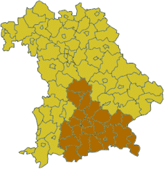 Map of Bavaria highlighting the Regierungsbezirk of Upper Bavaria |
|
| State | Bavaria |
| Region seat | Munich |
| Area | 17,529.41 km² |
| Population | 4,346,465 (31 December 2009)[1] |
| Pop. density | 248 /km² |
| Web page | regierung.oberbayern.bayern.de |
Upper Bavaria (German: Oberbayern) is one of the seven administrative regions of Bavaria, Germany, located in the south of Bavaria, around the city of Munich. It is subdivided into four regions (Planungsverband): Ingolstadt, Munich, Bayerisches Oberland (Upper Bavaria), and Südostoberbayern (South East Upper Bavaria). It is named 'Upper Bavaria' because the land is higher above sea level, not according to the map.
| Landkreise (districts) |
Kreisfreie Städte (district-free towns) |
|---|---|
|
|
Population
Historical Population of Upper Bavaria:
| Year | Inhabitants |
|---|---|
| 1939 | 1,999,048 |
| 1950 | 2,541,896 |
| 1961 | 2,831,744 |
| 1970 | 3,324,104 |
| 1987 | 3,598,126 |
| 2002 | 4,169,657 |
| 2005 | 4,238,195 |
| 2006 | 4,279,112 |
History
The duchy of Upper Bavaria was created for the first time with the First Bavarian partition in 1255 under duke Louis II but there was no exact identity with the current territory. After the reunification in 1340 Bavaria was divided again in 1349, and in 1392 the duchies Bavaria-Munich and Bavaria-Ingolstadt were created in Upper Bavaria. In 1505 Bavaria was irrevocably reunited. In 1837 king Ludwig I of Bavaria created the district of Upper Bavaria.
External links
- Official website (English) (German)
- Official website (German)
- Tourism website (English) (German)
|
|||||||||
Cite error: <ref> tags exist, but no <references/> tag was found